20 Day Cape Town, Botswana Safari
Departs from: Cape Town
Ends in: Cape Town
Length: 20 Days
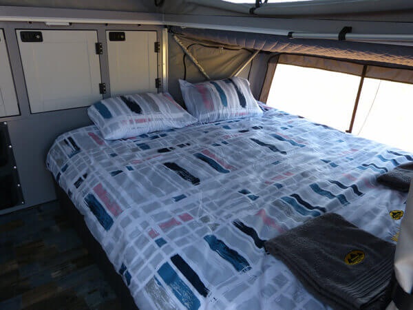
Accommodation: Camping off road caravan
Departure: Contact us for dates
For Bookings & Inquiries
Call Us
WhatsApp Us
Email Us

Day 1 Cape Town to Three Sisters – with your Tour Operators Cape Town
Distance approx. 536 km; driving time approx. 6 hours
We will collect you from your hotel, accommodation in Cape Town or surroundings between 6 and 7 am in the morning on the day of departure where we will go have breakfast at a wine farm and get to know each other and just go through the trip details. After breakfast around 10 am as your Tour Operators Cape Town, we will depart for Three Sisters this will be our first night stop. The Three Sisters are a land formation near Victoria West, Northern Cape, comprising three distinctively shaped hills. The hills (or “koppies” as they are known locally) are topped with dolorite, and are nearly identical in appearance. They can be seen just to the east of the N1 highway, roughly 75 kilometres (47 mi) outside Beaufort West, north of the junction of the N1 and the N12 highways. Due to the open and mountainous Karoo scenery, the area has become a relatively well-known landmark.
Day 2 Three Sisters to Douglas
Distance approx. 385 km; driving time approx. 4 hours
After a hearty South African breakfast, we take a leisurely drive to our nest destination a small-town Douglas. Douglas is an agricultural and stock farming town situated near the confluence of the Orange and Vaal Rivers in the Northern Cape province of South Africa. Notably the rural town has a diverse population, with mostly state institutions and the anchor private employer, GWK, an agricultural company. Douglas lies about 100km southwest of Kimberley the capital of the Northern Cape. These two are connected by the R357 road. The town was founded in 1848 as a mission station on the farm Backhouse by the Reverend Isaac Hughes[2], who had been working along the Vaal River since 1845. In 1867, a group of Europeans from Griquatown signed an agreement giving them the right to establish a town. The town was named after General Sir Percy Douglas, Lieutenant Governor of the Cape Colony.
Day 3 Douglas to Mokolodi Nature Reserve
Distance approx. 644 km; driving time 7 Hours approx.
Here we will be up with the sun to get an early start again. Mokolodi is a registered non-profit charity organisation – established in 1994 and is 3700 hectares in size. The land was donated into a Trust for the children of Botswana to provide a natural area that would allow them to learn about nature, conservation and the environment. Situated approximately 15 km south of Gaborone; the capital city of Botswana, the Reserve is home to a variety of mammals, including some rare and endangered species, and a diverse array of reptile, amphibian and bird species.
Conservation and Education are both at the core of the Reserve’s existence. If needed, your Tour Operators Cape Town can also go into Gaborone from here and do a bit of shopping for any items that may have been forgotten at home
Day 4,5 Mokolodi to Khama Rhino Sanctuary
Distance approx. 336 km; driving time approx. 3 to 4 hours
we will leave around 9 am in the morning so this means we can get in a good night’s sleep and be relaxed for the days short trip here we will spend our first night camping. Once we have set up camp here, we will take a game drive to one of the pans in the evening we will sit around the campfire and watch the stars. The Khama Rhino Sanctuary is a community-based wildlife project, established in 1992 to assist in saving the vanishing rhinoceros, restore an area formerly teeming with wildlife to its previous natural state and provide economic benefits to the local Botswana community through tourism and the sustainable use of natural resources. Covering approximately, 8585 hectares of Kalahari Sandveld, the sanctuary provides prime habitat for white and black rhino as well as over 30 other animal species and more than 230 species of birds.
Day 6,7,8 Khama Rhino Sanctuary to Kubu Island
Distance approx. 270 km; driving time approx. 4 hours
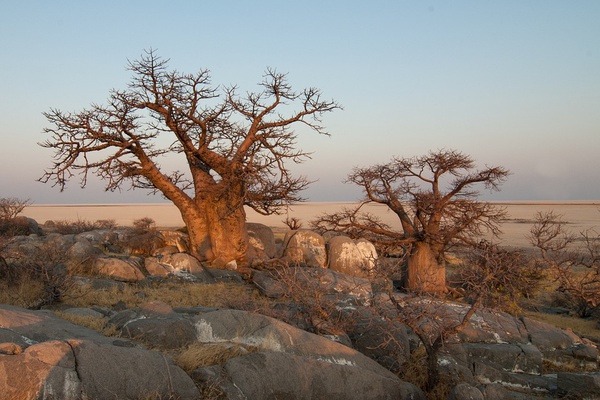
Kubu Island, or Lekhubu Island, is located in the South-West of the Sua Pan in Botswana, on its side the Sua, or Sowa, Pan is part of the Makgadikgadi Pans complex, that altogether cover an area of 16,058 sq. Km, the largest complex of salinas in the world. This is the most popular island of the whole pans complex and, unlike other islands, that are dunes of petrified sand, Kubu Island is made up of a granite outcrop, as well as Kukome Island, that is also in the Sua Pan.
This once was an island emerging from the great Lake Makgadikgadi, that in prehistoric times stretched for about 80,000 sq. Km in the basin of Kalahari; the signs of erosion by the lake’s waters on its rocks are still visible. In the Setswana language “Kubu” means “hippopotamus”, probably the name dates back to the time when the great lake, that was supposedly inhabited by hippos, was present; but the true name of the island is Lekhubu, that derives from Lekhubung, that, always in Setswana, means “rocky ridge”. Some scholars have found that these baobabs have had a huge growth over a certain period of their life, some 1,500 years ago, this suggests that, despite the Makgadikgadi Lake has dried up 10,000 years ago, at that time there was water again; subsequently, these marvellous giants have slowed down their growth, due to the lack of water.
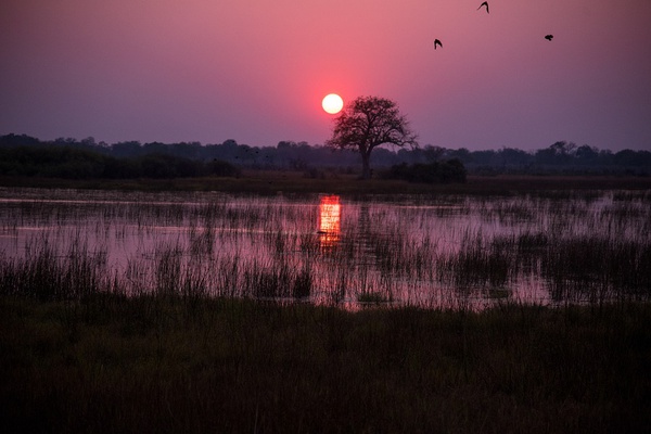
Kubu Island is surrounded by the unlimited white expanse of salt of the Sua Pan, on sunny days the blue sky seems infinite and the pan is of almost blinding white, while, when the sun sets over the pan, the warm light illuminates the island and its majestic baobabs; at night, when the moon shines in the sky, the white of the expanse of salt reflects so much its light that there are shadows as if there was the sun, a surreal atmosphere.
The island is in fact made up of a granite outcrop or kopje about 1 km long and 10 meters high; its slopes, in some points, appear to be terraced, here there are many rounded pebbles, that were shaped by the movement of the waves of the lake in the past. On Kubu Island there are several twisted baobab that are estimated to be 3,000 or 4,000 years old; they are impressive not only for their size but also because they seem to have so much to tell about the history of this island.
Day 9 Kubu Island to Elephant Sands
Distance approx. 191 km; driving time approx. hours
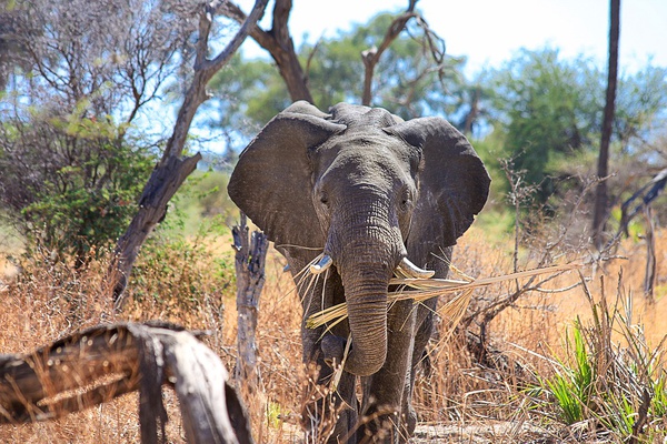
After breakfast, we will look at getting an early start here as we would like to get to our next destination in good time so that we may get a camp site right in front of the water hole where you can relax in the comfort of your camp and watch the elephants dinner will be around the camp fire prepared by your guide. Elephant Sands is a bush lodge & campsite in the northeastern part of Botswana. Come and enjoy viewing the elephants at our natural waterhole right in front of the lodge. Watch these impressive creatures whilst they drink at only a couple of meters away from you, a unique experience. There is plenty of other wildlife around as well on our unfenced 16000 ha private conservancy. The lack of fences allows all animals to roam freely.
Day 10,11,12 Elephant Sands to Moremi Game Reserve
Distance approx. 444 km; driving time approx. 5,30 hours
Our second 3 night stop we will spend at the South Gate Campsite it’s the first camp as you enter the park from here, we will explore the surrounding arias with a game drive. Moremi Game Reserve is situated in the central and eastern areas of the Okavango, and includes the Moremi Tongue and chief’s island, boasting one of the richest and most diverse ecosystems on the continent. This makes for spectacular game viewing and bird watching, including all major naturally occurring herbivore and carnivore species in the region, and over 400 species of birds, many migratory and some endangered.
Both Black and White Rhino have recently been reintroduced, now making the reserve a ‘Big Five’ destination. Contained within an area of approximately 3900 sq. kms, here land and Delta meet to create an exceedingly picturesque preserve of floodplains – either seasonally or perennially wet, waterways, lagoons, pools, pans, grasslands and riparian, riverine and mophane forests. This terrain makes driving Moremi’s many loops and trails both delightful and, at times, totally inspiring.
Day 13 South Gate Camp to Ghanzi
Distance approx. 377 km; driving time approx. 5 hours
We will spend the night at the Tautona Lodge in one of their chalets. Ghanzi is a town in the middle of the Kalahari Desert the western part of the Republic of Botswana in southern Africa. At the time of the 2011 census, there were 12,167 people living in the town with another 861 nearby. It is the administrative centre of Ghanzi District and is known as the “Capital of the Kalahari”
Day 14,15,16 Ghanzi to Mabuasehube
Distance approx. 459 km; driving time approx. 7 hours
The Mabuasehube Game Reserve is located in the Kalahari Desert covering an area of almost 2000 square kilometres. The unforgiving desert terrain is characterised by high red dunes and scattered vegetation. In 1992 the reserve was incorporated into the Kalahari Gemsbok National Park, and in 2000 it was also integrated into the Kgalagadi Transfrontier Park. The reserve’s name is derived from the Senalonga language and means “red earth”. The reserve was once home to the San people, sometimes called Bushman, and to small groups of inhabitants called the Kgalagadi people. The rustic campsites are unfenced and do not have electricity or running water. Therefore, visitors are required to bring adequate supplies of fuel, food and water.
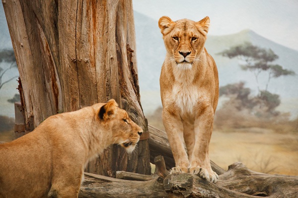
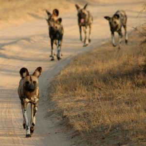
Those who visit the reserve will discover a dramatic and contrasted landscape. The main attractions at Mabuasehube are the three large salt pans and various smaller ones, which are all divided by small sand dunes. Due to the harsh climate of the region large herds of game of gemsbok and eland are attracted to these pans for both water and to lick salt. Other species of wildlife regularly sighted at Mabuasehube include lion, leopard, wild dog, cheetah, both brown and spotted hyena, warthog, bat-eared foxes, jackal, springbok, wildebeest, oryx, kudu, steenbok, duiker, and a variety of other antelope.
Day 17 Mabuasehube to McCartheys Rest
Distance approx. 146 km; driving time approx. 5 hours
This will be a slow drive again due to the road conditions here we will also be crossing the border back into South Africa. We will spend the night at a Springbok Guest Farm not far from the border on the South African side. In the morning we will be up very early as we have a long road ahead of us to get to our next destination in good time
Day 18 McCartheys Rest to Augrabies Falls National Park
Distance approx. 517 km; driving time approx. 6 hours
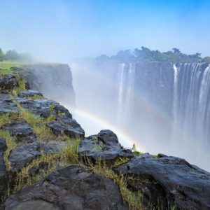
Augrabies Falls National Park is a national park located around the Augrabies Falls, about 120 km west of Upington in the Northern Cape Province, South Africa. It was established in 1966. The Augrabies Falls National Park covers an area of 820 km sq and stretches along the Orange River. The area is very arid. The waterfall is about 60 metres high and is awe-inspiring when the river is in flood. The gorge below the falls averages about 240 m deep and runs for 18 kilometres. The gorge provides an impressive example of erosion into a granitic basement.
The original Khoikhoi people named the waterfall Ankoerebis, meaning the “place of big noises”. The Khoi and San communities within the greater national park inhabits domed huts called ‘matjiehuise’ (mat houses). The huts are ideal for both hot and cold climates. During hot temperatures the tree stems from which the mats are created shrink, which allows gaps to appear – creating a cooling ventilation system. The inverse occurs during cold climates, as the stems expand to keep the cold out.
The Trekboers who later settled in the area derived the name Augrabies. The name is sometimes spelt Aughrabies. There are many deposits of alluvial diamonds along the Orange River and legend has it that the biggest cache of diamonds in the world lies in the swirl-hole eroded into the granite at the foot of the waterfall by the thundering waters.
Day 19 Augrabies Falls to Klawer
Distance approx. 610 km; driving time approx. 6 hours
This is our final night with your Tour Operators Cape Town, where we will stay camp over on a working wine farm enjoy a good meal together and look back on the trip over a glass of wine or 3
Day 20 Klawer to Cape Town
Distance approx. 271 km; driving time approx. 3 hours
After a sleep in and breakfast, we will head back to Cape Town where you will be dropped at Cape Town International Airport or Cape Town surrounding place of your choice.
What’s Included
Registered guide fluent in English and German
All camping, park and safari fees as per itinerary
Breakfast and dinner daily
Selected beverages
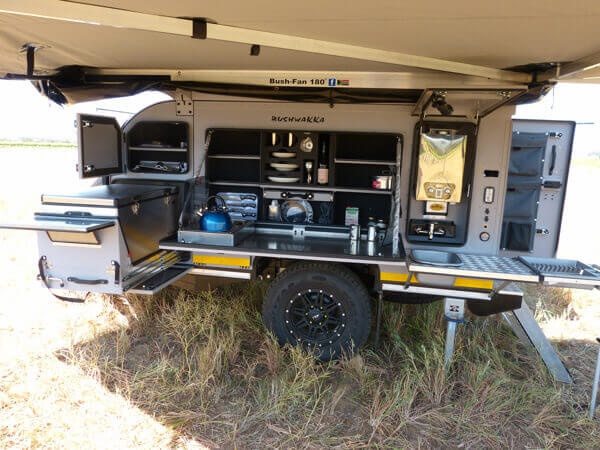
All transport in a fully equipped 4×4 vehicle
Accommodation in an off-road caravan with double bed
Bedding and towels
Game drives
Fuel
Expert Tour Operators Cape Town
Activities as per itinerary
What’s Excluded
All flights and visas and border fees
Personal & medical insurance
Personal belongings
Tips, curios and any optional excursions and activities
Passports
Vaccinations
Visas
We are the Tour Operators Cape Town can be proud of
Join our mailing list